Part II: Into the Open Ocean
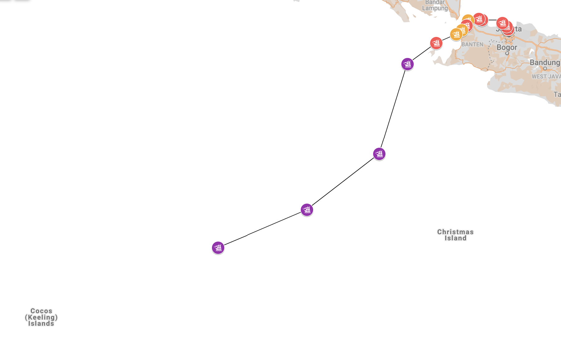
Passing Prinsen Island, the Schonenberg is now heading for open water.
You have never truly seen a ship until you have seen it at sea, a sailor once told me. When the sails are full, the bow splitting the ocean in two, the power of the wind converted into pure forward momentum – then, and only then, is the ship itself.
Square rigged sailing ships, like Schonenberg, have long disappeared from the oceanic trading routes. They were something entirely different to the engine-driven vessels that replaced them in the early 1900’s. Very few videos of square riggers exists – cameras came in right around the time the last of them were being retired – and so this video from 1929 is unique. For a taste of how a voyage like the one we’re revisiting might have been, take a look. You might think that 1929 is a long time after 1722; the reality is that very little changed over the centuries in how these ships were sailed.
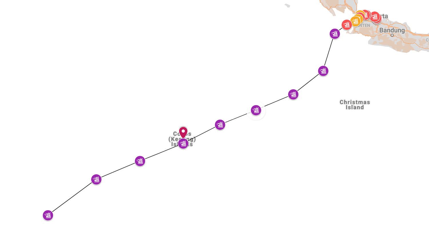
Voyage Track so far: Full Map
After a slow start, Week Two for the Schonenberg has a more interesting beginning. Dead ahead of the ship, two items of interest: Krakatau, and Pirates.
How do we get to Africa?
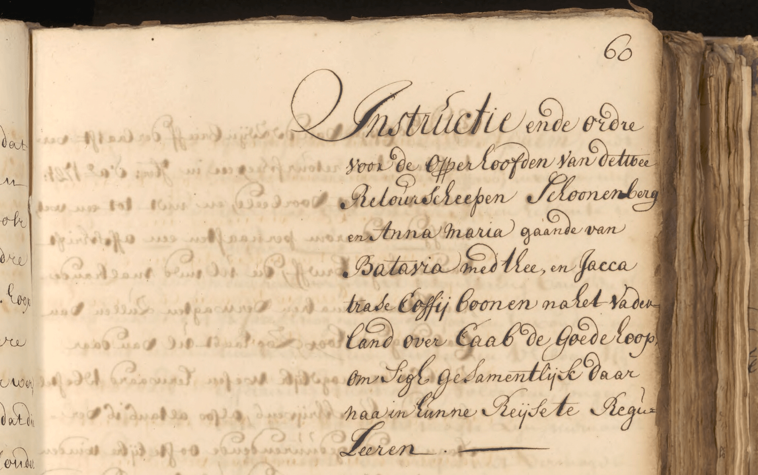
Among the documents presented to the captain of the Schonenberg, the most important was the Zeijnbrief – the sailing instructions. They run to about forty pages, and are perfectly preserved in the VOC archives. The briefing was uniquely prepared for the Schonenberg, and contained very specific company orders, and route instructions.
By translating the instructions into English, and then plotting the waypoints, we can recreate the planned route of the Schonenberg with relative ease.
There are 5 key junctures in the journey instructions:
- Leaving Prince Island, sail using the south-easterly wind to a latitude of 10-12° S as quickly as possible. > 11°S 102°E
- Then, take a WSW (247°) course until the longitude of St Brandon and latitude 24-26°S. > 24°S 60°E
- Remain 85 miles (340nm) away from Madagascar until 70° = 52° E corrected for Ferro Meridian. > 27°S 52°E
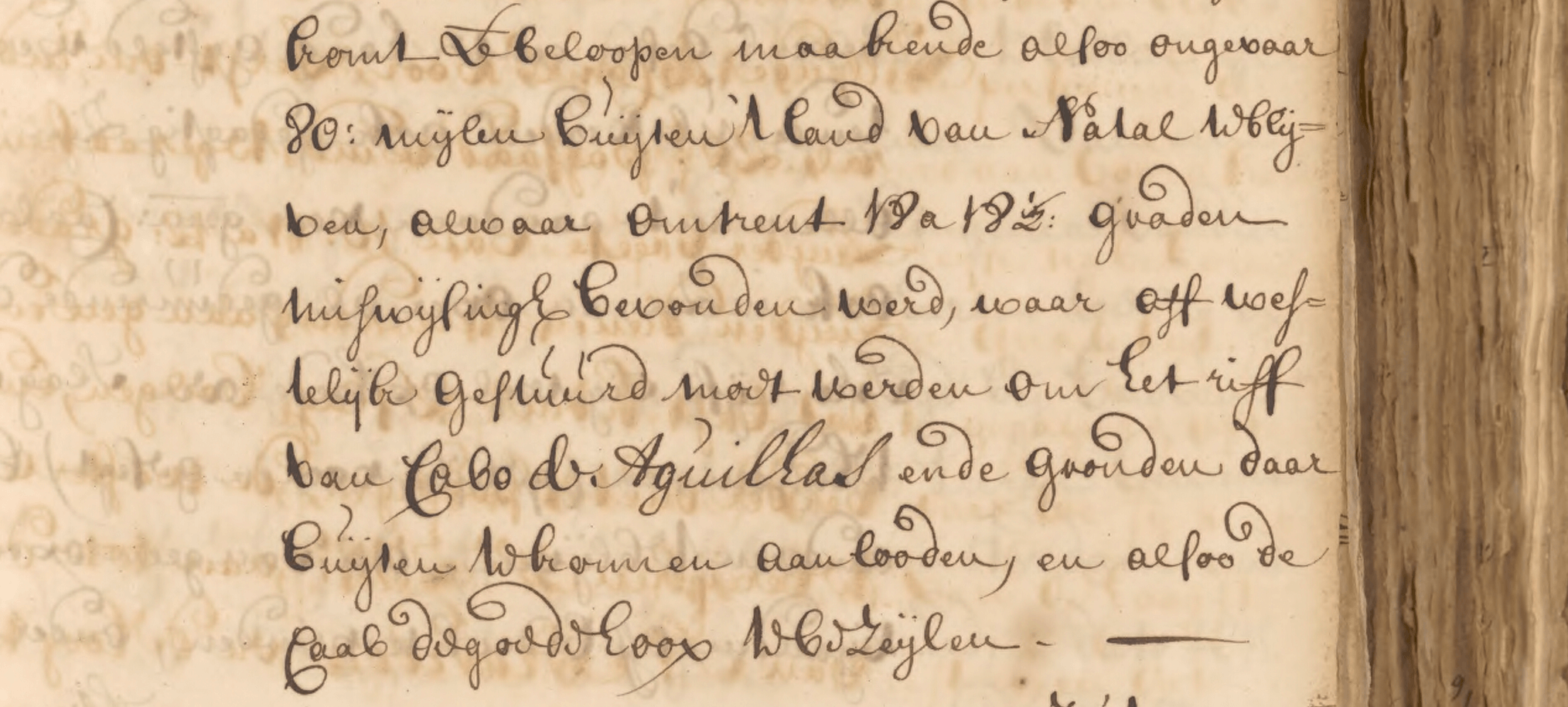
- Take a course of SW by W (236°) (True, assumed) to the latitude of 35° S, which will place you 80 miles (German) outside Natal = 320nm away from coast > 35°S 35°E
- Take a westerly course to avoid Cape Agulhas > 35°S 20°E
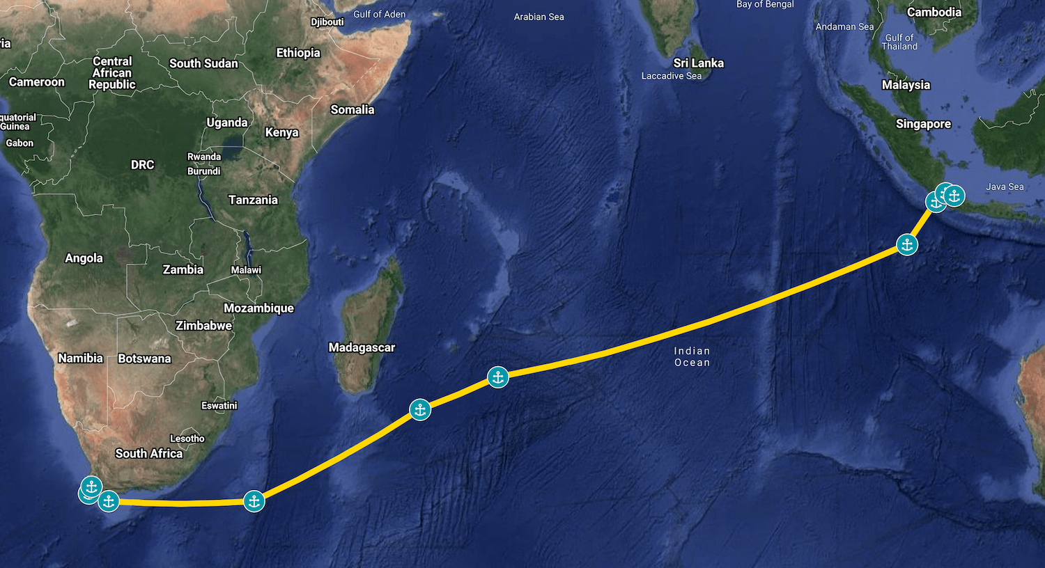
From this, we can work out the distance of the planned route from Batavia to Cape of Good Hope, which is:
9,843 kilometres
5,314 nautical miles
1,328 Dutch sea miles (Duitse mijl, the units used by the VOC)
Saturday, October 3rd (Day 9)
“Op saaterdagh den 3 october Smorgens met zons opganck de windt van ZZO tot ZO t Z: konde geen lant zien waar t: Prinse Ijlant zonder gezien te hebben gepasseert: inde voormiddagw: staaken een Rif in ijder marzeijl (in margin: dito lagen onse compasse op 5 gr. NW: steringh) dito Smiddaghs hadde wij de gegiste Zbr. Van 6 gr. 50 mid Langhte van 123gr. 50 mid: dito stelde onse breete en langhte vast: gisse zeedert de laaste Pijlingh 26 mijle gezeijlt te hebben door de sterke stroom die om de zuijt de straat uijt liep: Inde agtermiddagw: de wint vant ZOost marz:s koelte weer voors de geheele naght.”
At sunrise on the 3rd, the wind South South-Easterly, could see no land, we passed the Prinse Island without having seen it. In the morning watch (0800-1200) put a reef in each topsail. At midday we had the reckoned Latitiude of 6 degrees 50 minutes, and 123 degrees 50 minutes longitude. Estimated since the last fix to have sailed 26 miles through the strong current flowing out to the south of the straits.
Latitude then, is as now – so we can fix the postion at 6°50′ S
Longitude needs to be converted. The Dutch used El Hierro, in the Canaries, as the zero meridian. It lies 18º 10′ east of Greenwich, so we have to deduct that from any longitudes mentioned to get todays value.
So 123º 50′ becomes 105º 40′ E, and the position of Schonenberg at midday on October 3rd is 6°50′ S 105º 40′ E.
This position doesn’t line up – it’s too far east. Let’s look at the next days log. Looks like one degree fixes it – should be 6°50′ S 104º 40′ E
Sunday, October 4th (Day 10)
“Op sondagh den 4 dito Smorgens met zonne opganck de windt vant ZO t Ooste gereefde marz:s coelte: goet weer. Dito Smiddaghs hadde wij de gegiste Zbr. Van 8 gr. 44 mid: de bevonde Zbr. Van 8 gr. 44 mid Langhte van 122 gr. 14 mid: de behoude coers is ZW t West 31 mijl: op dato stake ons Reeven uijt de marz:s: [In margin: dito kapte wij de helft van de voor looper van ons daghslijks Touw af als t niet meer te vertrouwe zijnde onbequaam] Inde aghtermiddagwaght de windt van OZO tot ZO t Ooste marzijls coelte dijsighe lught goet weer: Inde Eerste waght de windt vant ZO t Ooste frisse marz:s coelte: Betrocke lught voors de geheele naght windt en weer als booven.”
At sunrise, the wind is south-easterly, force 7 (28-33 knots), good weather. At midday estimated position 8°44′ S 122º 14′ E, course SW by W (236º), 31 miles.
Converting to todays longitude, we get 8°44′ S 104º 04′ E. The distance matches: 31 miles from the previous fix at midday the day before.
Monday, October 5th (Day 11)
“Op maandagh den 5 october Smorgens met zonne op ganck de wint vant ZO t O: marz:s coelte moeij weer. Dito Smiddaghs hadde wij de bevond ZBr. Van 9 gr.55 mid de gigiste Zbr. van10 gr. 17 mid Langhte van [1]20 gr. 41 mid de behoude coers Zwest 33 mijl: op dato veranderde koers stierde WZWest aan. Inde agtermiddaghwaght de windt van OZO: Frisse bramz:s en marz:s coelte. Inde Eerste en hondewaght de windt vant O t Z moeij weer.“
Bevonden vs Gegigste breedte
Converted midday position: 9°55′ S 102º 31′ E
Tuesday, October 6th (Day 12)
“Op dinghsdagh den 6 dito Smorgens met zonne opganck de windt van O t Z: marz:s en bramz:s coelte. Dito smiddaghs hadde wij de bevonde Zbr. van 10 gr. 43 mid gegiste Zbr. van 10 gr. 43 mid Langhte van 118 gr. 47 mid de behoude coers WZW 30 ½ mijlle: Inde aghtermidddaghwaght de windt vant O t Zuijde bramz:s coelte moeij weer. Zagen veel gevogelte: Inde Eerste en hondewaght de windt O t Z tot OZOost bramz:s coelte goet weer. Op dato is overleede den mattroos Gerrit Antonisse van Amsterd:“
Converted midday position: 10°43′ S 100º 37′ E
Distance matches exactly: 30.5 (German) miles – 122 nautical miles, 226km. With 24 hours between the midday postion fixes, we can work out the average speed: a hair over 5 knots.
Some new notes in the log today: saw a lot of birds, the wind east by south, good weather, and the sailor Gerrit Antonisse from Amsterdam died today.
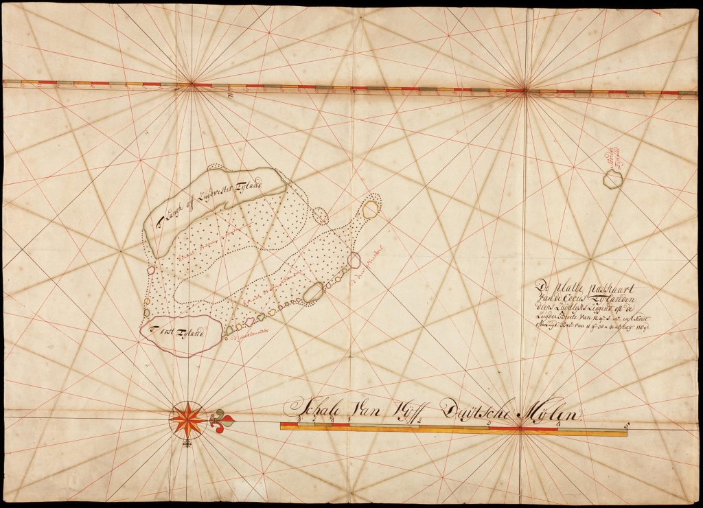
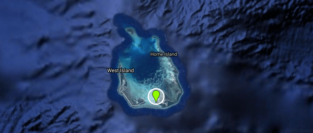
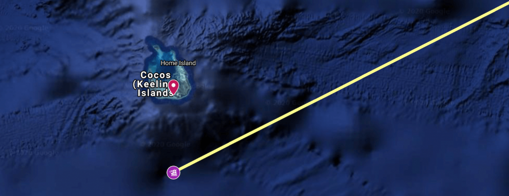
There’s a new problem on the horizon – literally. The Keeling Islands.
Wind measurements
The log entries often refer to wind strengths like “Bramzijls koelte” and “Stijve marszeils koelte”. These are connected to the state of the sails, and equate to the Beaufort scale on the left.
| Beaufort | Sail state | Wind name |
|---|---|---|
| 0 | Ruimschoots; Geen vaart | Slecht water; Stil |
| 1 | Ruimschoots; Er is stuur in het schip | Flauw stuur; Flauwe koelte |
| 2 | Ruimschoots; 1 tot 2 mijls vaart | Labber koelte |
| 3 | Ruimschoots; 3 tot 4 mijls vaart | Topzeils koelte |
| 4 11-16 kts | Ruimschoots; 5 tot 6 mijls vaart | Bramzijls koelte |
| 5 17-21 kts | Vol en Bij; met bovenbramzeils | Stijve bramzeils koelte |
| 6 22-27 kts | Vol en Bij; met onderbramzeils en 1 rif in de marszeils | Marszeils koelte |
| 7 28-33 kts | Vol en Bij; geen bramzeils; 2 reven in de marszeils | Stijve marszeils koelte |
| 8 | Vol en Bij; geen bramzeils; 3 reven in de marszeils | Dicht gereefde marszeils koelte |
| 9 | Vol en Bij; dicht gereefde marszeils met onderzeilen | Onderzeils koelte |
| 10 | Dicht gereefd onderzeil en gereefde fok | Gereefde onderzeils koelte |
| 11 | Alleen storm stagzeil | Storm |
| 12 | Zeilen waaien uit de lijken | Orkaan |
Wednesday, October 7th (Day 13)
“Op woensdagh den 7 october Smorgens met zonne opganck de windt van O t Zuijde Bramz:s coelte moeij weer – dito Smiddaghs hadde wij de bevonde Zbr. van 11 gr. 26 mid: de gegiste Zbr. van 11 gr. 28 mid Langhte van 116 gr. 56 mid de behoude coers WZw: 29 ½ mijlle. Inde aghtermiddaghwaght de wint vant OZOost frisse bramz:s coelte goet weer: Inde Eerste en honde waght de windt van ZO t Ooste Helder weer voors de geheele naght.“
At sunrise, the wind E by S, 7-10 knots, nice weather. At midday, measured 11 26 south, estimated 11 28 south, longitude 116 56 east, with the course holding WSW, 29½ miles sailed. In the afternoon watch the wind ESE, 17-21 knots, good weather. In the first and the dog watches the wind SE by E, clear weather the whole night.
Converted midday position: 11°28′ S 98º 46′ E
Thursday, October 8th (Day 14)
“Op donderdagh den 8 dito Smorgens met zonne opganck de windt vant ZOost moeije bramz:s coelte goet weer: dito Smiddaghs hadde wij de bevonde Zbr. van 12 gr. 24 mid. De gegiste Zbr. van 12 gr. 12 mid Langhte van 115 gr. 3 mid de behoude coers ZW West 30 mijlle. Inde aghtermiddaghwaght de windt vant ZO t Ooste frisse bramz:s coelte goet weer: Inde Eerste en honde waght de windt vant OZOost marz:s en bramz:s coelte goet weer voors de geheele naght windt en weer als boven.“
The weather conditions are now more or less the same each day: a fresh south-easterly wind, good weather, good sailing, and good progress.
The converted midday position is: 12°12′ S 96º 53′ E
This creates an interesting conundrum. The position is right in the middle of the Keeling islands.
Clearly, the Schonenberg did not sail this close to land, especially not without mentioning it in the log. So far, we have been using the estimated positions in the logbook each day, which the ships navigators calculated by dead reckoning. This involves two separate inputs:
- The speed – measured with a log line and an hourglass. The log is put in the water, the number of knots on the line are counted in a period of 14 or 18 seconds.
- The course – measured using the ships compass, corrected for compass error and magnetic variation to get true course.
From those, distance covered can be calculated, resulting in a lat/long fix that becomes the estimated position (gegiste)
At midday, a fix on latitude was taken using an octant (the sextant was not yet in use) – and this became the found position (bevonden)
If we take the found position on the 8th (by octant), the position becomes 12°24′ S 96º 53′ E. This makes sense, because it puts them about 17km (2 mijl south of the islands)
Nonetheless, there is no entry in the log noting a position fix from the island. 17km is just on the limit of the distance that a ships observer might see land – the Keeling islands are no higher than 5 metres. Therefore, considering also that they might have been further south than the reading taken on the octant at midday (it would only be accurate to a few minutes of latitude), we can assume that the crew passed the islands without seeing them, though they would have been on sharp lookout for them.
From here onwards, there is no further land on the route until they get close to Madagascar, still some 5,000 km away.
Friday, October 9th (Day 15)
“Op vrijdagh den 9 octob:r Smorgens met zonne opganck frisse bramz:s coelte betrocke lught dito smiddaghs hadde wij de gegiste Zbr. van 13 gr. 17 mid Langhte van 112 gr. 50 mid de gegiste behoude coers WZWest 35 mijle. Inde agtermiddaghwaght de windt van ZO tot ZO t Ooste marz:s en bramz:s coelte goet weer: Inde voors de geheele naght de windt als booven.“
The sailors of the Schonenberg are now beginning their third week at sea. The first, painfully slow progress weaving through the islands of Java, stopping and starting at the whim of the wind, and the second, out in the open ocean, on track and progressing well. Today, no octant reading is taken. The ship makes 35 miles since yesterdays position, the biggest ground covered yet, at almost 6 knots.
Midday position: 13°17′ S 94º 40′ E
Saturday, October 10th (Day 16)
“Op saaterdagh den 10 dito Smorgens zonne opganck de windt vant ZO tot OZO Travadige lught met Reegen: dito Smiddaghs hadde wij de gegiste Zbr. van 14 gr. 12 mid Langhte van 110 gr. 35 mid de gegiste behoude coers WZW 35 mijl: inde agtermiddaghwaght de windt vant OZO tot Oost marz:s en bramzeijls coelte: Inde Eerste en hondewaght de wint vant O t Z: bramz:s coelte voors geheele naght.“
The journal entries are becoming familiar. South east wind, tracking well. Today, for the first time, the crew encounter stormy weather. Travadige lucht indicates the presence of thunderstorm activity.
Midday position: 14°12′ S 92º 25′ E
Distance covered since yesterday: 264km, 142nm (35 mijl)
Total distance:
Sunday, October 11th (Day 17)
“Op sondagh den 11 October Smorgens met zonne opganck de windt O t Z to OZOost marz:s en bramz:s coelte moeij weer dito Smiddaghs hadde wij de bevonde Zbr. van 15 gr. 59 mid de gegiste Zbr. van 15 gr. 12 mid Langhte van 108 gr. 6 mid: de behoude coers WZWest Zuijt 39 mijlle: Inde aghtermiddaghwaght de windt vant O t Z tot OZO: bramz:s coelte helder weer voors de geheele naght.“
For the first time since the Keelings, the crew took a fix on the octant at midday, finding themselves at 15°59′ S. Since it has been 3 days since the last reading on the octant, the inaccuracies in dead reckoning can be seen: their estimate was that they were at 15°12′ S. Those 47′ minutes of latitude equate to 47nm, or 87km. Of course, the longitude could only ever be estimated by the crew, and this is even harder to keep track of. After several weeks at sea, it become guesswork as to how far west they have actually progressed. It was not until later in the 18th century that ships at sea could reliably determine longitude.
Midday position: 15°59′ S 89º 56′ E
Distance covered since yesterday: 333km, 179nm
(higher because of latitude correction)
With their octant reading on the 11th, the corrected position can be seen.
Monday, October 12th (Day 18)
“Op maandagh den 12 dito Smorgens met zonne opganck de windt vant OZO bramz:s coelte moeij weer dito Smiddaghs hadde wij bevonde Zbr. van 16 gr. 59 mid de gegiste Zbr. van 16 gr. 48 mid Langhte van 106 gr. 3 mid de behoude coers WZWest 32 mijlle. Inde aghtermiddaghwaght de windt vant ZO t O tot ZO frisse bramz:s coelte goet weer: Inde Eerste en hondewaght de windt vant ZOost tot OZOost moeije weer bramz:s coelte voors de geheele naght weer en windt als booven.“
Midday position: 16°59′ S 87º 53′ E
Distance covered since yesterday: 246km, 132nm (33 mijl)