Our first ancestor, Bruno Zee, was a member of the crew of the 800-ton VOC retourschip Schoonenberg, which left Batavia (now Jakarta, Indonesia) on Friday, September 25th, 1722 with destination Holland. It sank off the coast of South Africa two months later, after hitting a reef in darkness.
I thought it might be interesting to re-trace the route of this mammoth voyage. Very few VOC ships of the 17th and 18th century have records preserved in the same detail as Schoonenberg. Ironically, the reason for this is the very fact that it sank – but the logs were salvaged, and kept after a court of enquiry.
The primary source for this day by day account is the ships log, kept by Albertus van Soest. As events unfold after the shipwreck, and the crew mutiny against him, his entries become a mix of fact and fiction, but for the ocean-going part of the story, they ought to be fully reliable.
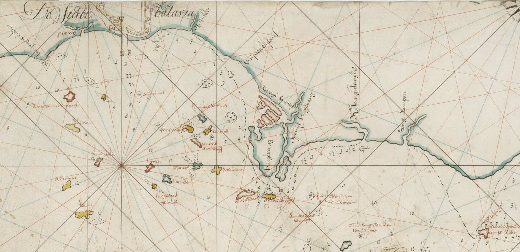
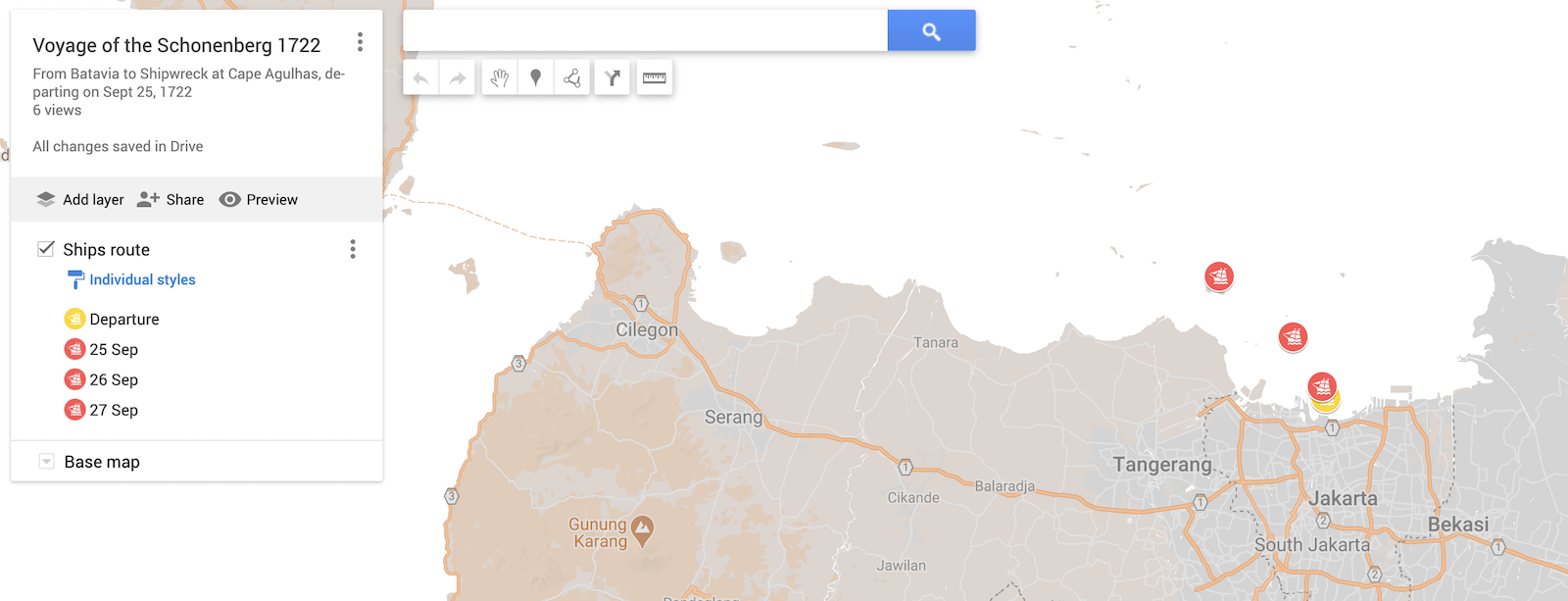
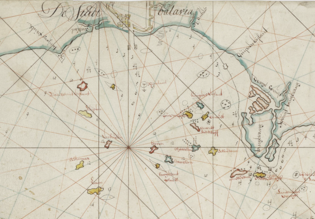
Reading the log carefully it is possible to calculate positions when they are not specifically noted as coordinates. I will display the route on a present day map. The first few days sailing positions are shown here.
Friday, September 25th, 1722 (Day 1)
“Joernael Boek gehouden Int Schip Schoonenbergh gedestineert naar Patria: beneffens ons In Compagnie t. Schip de Anna Maria voor de Camer Zelant daar schip:r op is: Corneelis Fret in wij voor de Camer Amsterdam: als wimpelvoerder gekommand:t door mij Albertus van Soest: en gemonteert met 28 stucke en 110 koppe: gelade met koffie en Tee en zuijker: en Peeper en Sapan houdt “
Captain Albertus van Soest starts his diary on September 25th, in the port of Batavia. The ship was sailing in the company of the Anna Maria, skippered by Cornelis Fret. The Schoonenberg was the lead vessel, or wimpelvoerder, and carried 28 canons, and 110 men, laden with coffee, tea, sugar, pepper, and sapanwood.
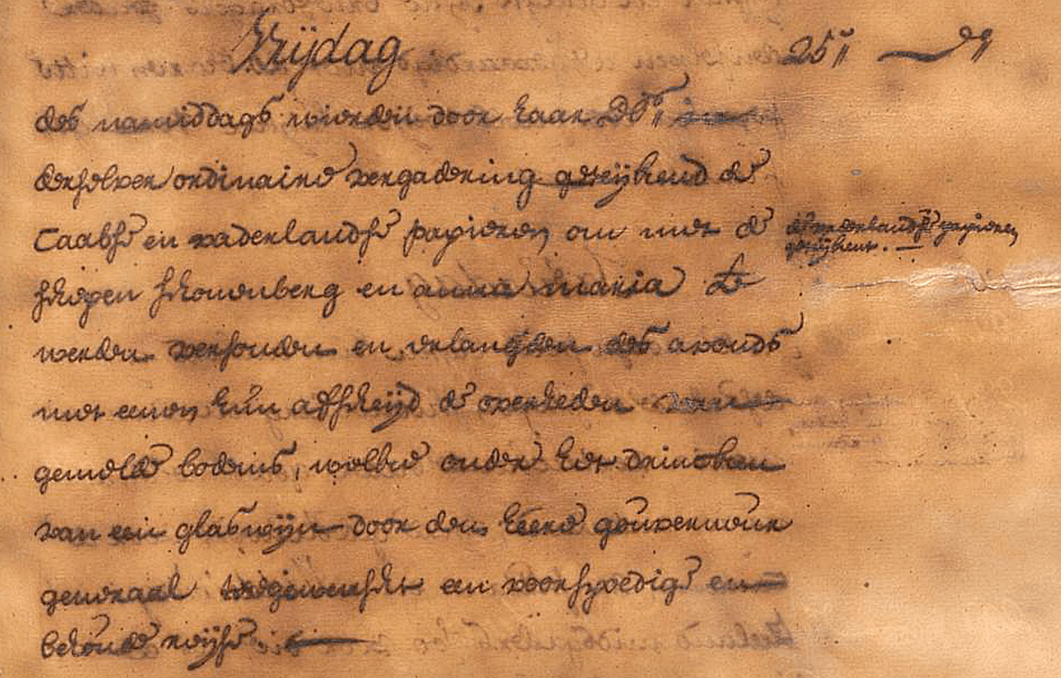
In daily journal of Batavia Castle, the VOC HQ, it was noted that the captains of the Schoonenberg and Anna Maria were invited to a special meeting on Friday afternoon hosted by the Governor of Batavia, Hendrik Zwaardecroon, in which the papers being sent home to Holland were signed. Then, all present drank a glass of wine, and the Governor wished them a safe and favourable journey.
The first entry in the ships log reads: “Op vrijdagh den 25 septemb:r quaam de h:r Vicael aan boort om te monsteren en zijlde tot verbij de mantel en quaame door de zee wint (w?)eer ten ancker.”
Mr. Vicael came on board to muster the crew, and we sailed until past the mantel, and came to anchor.
The mantel was the mooring that the Schoonenberg would have been attached to while loading. This first movement was just to reposition the ship away from that, and hold position under her own anchor. This marked the official departure was mid-afternoon and sunset was at 6.15pm. The most they would have sailed is a mile or two.
Starting position: 6° 5′ S 106° 49′ E (calculated)
Saturday, September 26th (Day 2)
“Op saaterdagh den 26 dito smorgens met den dagh Lighte ons ancker op en ginge onder zeijl: En quaame weer ten ancker.“
At daybreak we raised our anchor and went under sail. And came again to anchor.
Distance sailed: 4 nautical miles (nm) / 7km.
Position: 6° 1′ S 106° 47′ E (calculated)
Sunday, September 27th (Day 3)
“Op sondagh den 27 dito smorgens met den dagh Lighte ons ancker en ginge weer onder zeijl: En quame bij bij de Ijlande Amsterdam en Middelburgh ten ancker en bleeven de heele naght leght.“
At daybreak we raised our anchor and went under sail again. And came to beside the islands Amsterdam and Middelburgh again to anchor, and stayed the whole night there.
Progress was again rather slow – by sunset they had reached the Amsterdam and Middelburgh islands, still within the confines of Batavia Harbour, sailing about 6 nautical miles.
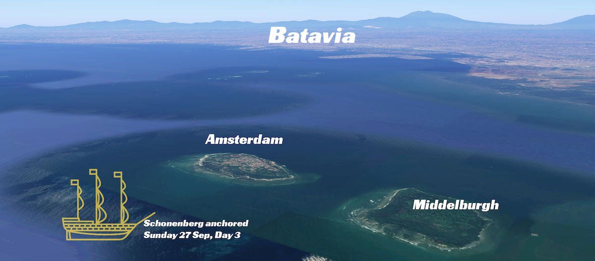
Distance sailed: 7 nautical miles (nm) / 12km.
Position: 5° 57′ S 106° 42′ E (calculated)
Total distance: 11 nm
Monday, September 28th (Day 4)
“Op maandagh den 28 dito smorgens de wind landeleijk lighte ons ancker op en ginge ond:r zeijl soghde de koers buijte de kombuijse heen: op de middagh kreegent zee windt en braghte het daar meede met zons onderganck ten ancker. Pijlde T: midde van poele babie int N:N:Oost van ons.“
“With the wind from the land, we raised anchor and sailed, aiming for a course outside the Kombuijsje, after midday it changed to an onshore wind and stayed like this until sunset. Bearing taken to the middle of Poele Babie, in the N:NE from us.“
The direction sailed on the Monday was west, along the northern coast of Java. A landelijk wind means coming from the land, or an offshore breeze, which is normal for morning sailing. The wind was therefore from the south, or the left.
The course was taken to avoid the kombuisje island. At regular intervals, normal procedure was to take a bearing from land visible in the distance, to fix a position. This is known as pijlen. That evening at sunset, their bearing taken was to the island of Poele Babie (now renamed Tunda Island), as being in the North-North East (NNE).
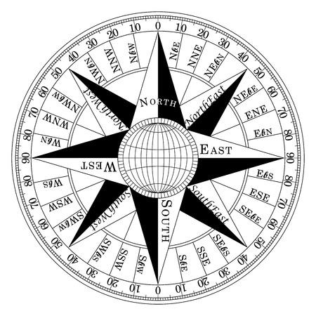
In the world of the VOC and navigation in 1722, a 32 point compass was used. Directions were always referred to in combination points like NNE, rather than numbered degrees like today, where we would use 022°.
To figure out the position of the ship on night four, since the log states that they sailed from Amsterdam and Middelburgh islands to a position where the island of P. Babie was in the NNE, that means that they were SSW of the island. So, the days track looked like this:
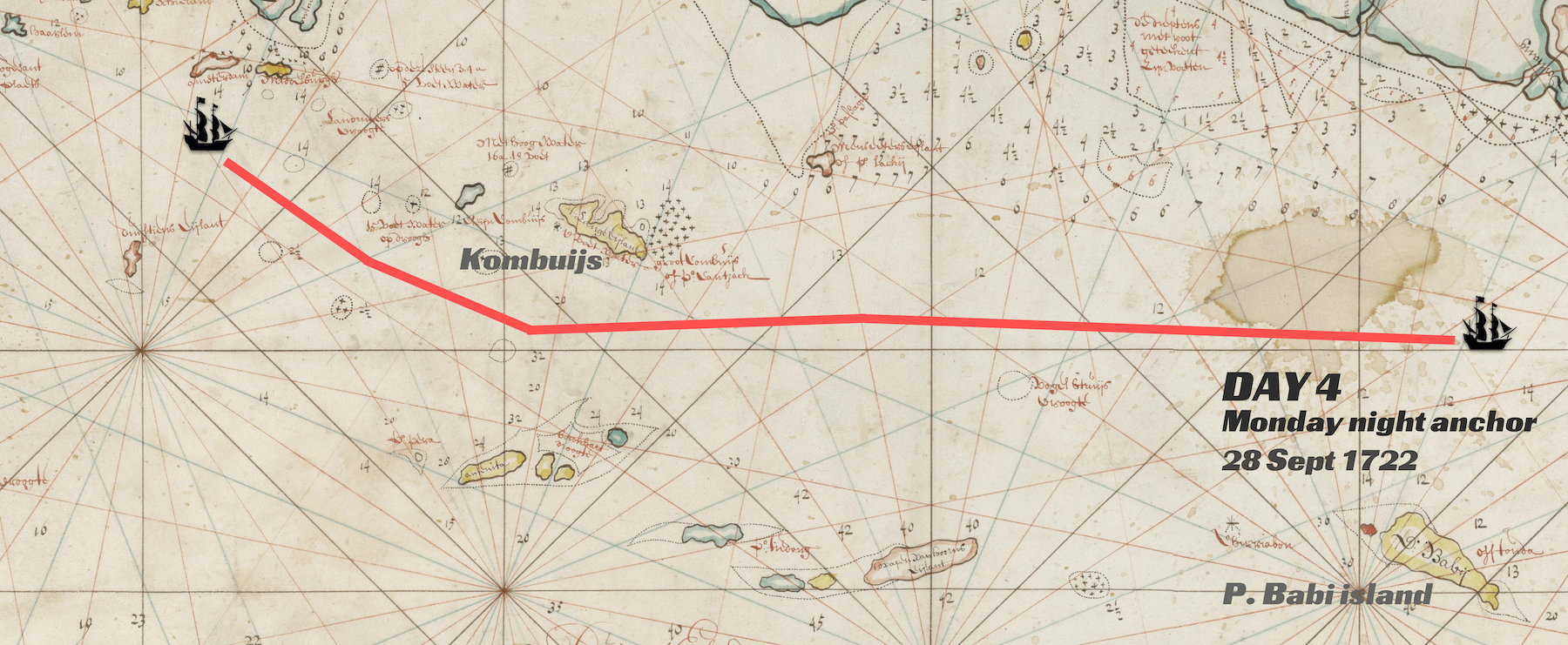
Distance sailed: 28 nautical miles (nm) / 51km.
Position: 5°53′ S 106°15′ E
Total distance: 39 nm (72km)
Tuesday, September 29th (Day 5)
“Op dinghsdagh den 29 Septemb:r smorgens light met het lant wintie ons ancker dogh moste kort daar naar door doot stilte en Tegen windt weer anckeren: waare wijnigh geavanceert voors de geheele naght meest doodt stilte.“
In the morning with a land breeze we raised anchor, but shortly afterwards through dead calm and headwind, has to anchor again. Made little progress. The whole night mostly dead calm.
Wednesday, September 30th (Day 6)
“Op woensdagh den 30 dito smorgens nogh al doodt stilte bleeven leghen: Int 2 glas cregent zee wintie uijt den W:N:West en N:West zoo dat de windt te schraal zijnde om te zeijlen moste blijve leghen: voors inde agtermid: de windt als booven en snaghs meest doodt stilte.“
In the morning it remained dead calm, we stayed put. In the 2nd glass we got a litle sea breeze from the WNW and NW, but it was too weak to sail and so we stayed put. In the afternoon, and night, the same.
As such, no movement at all on Wednesday.
Thursday, October 1st (Day 7)
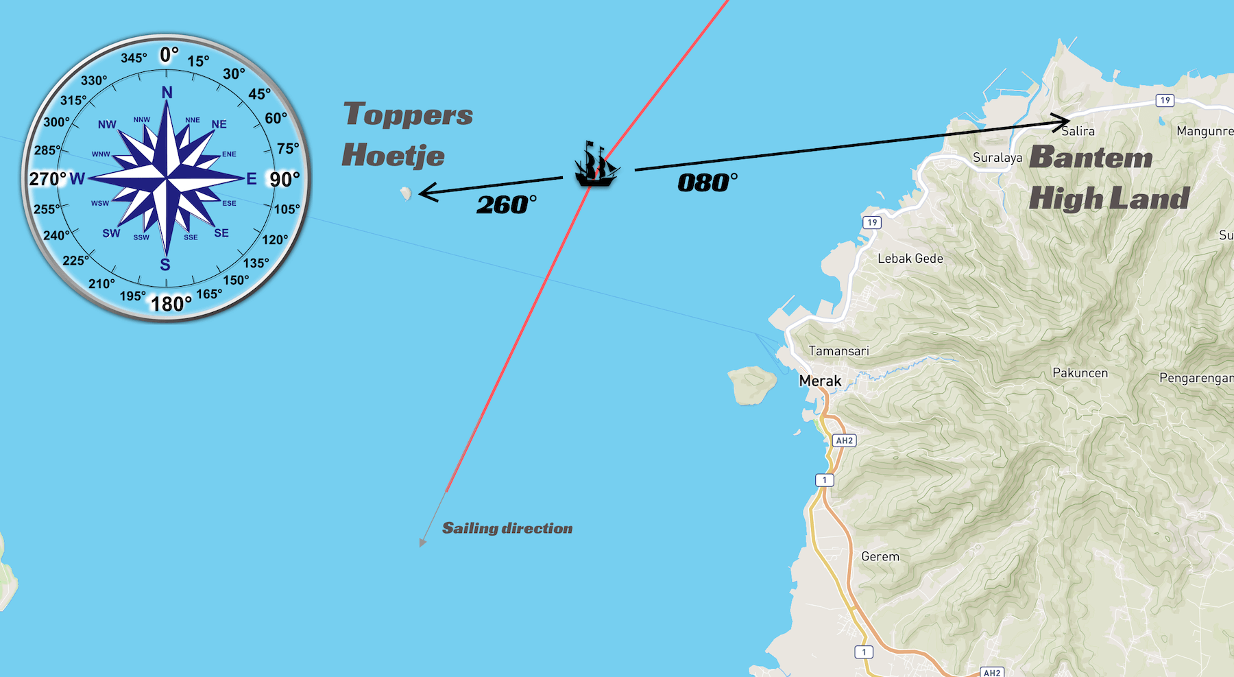
“Op donderdagh den 1 October Smorgens met den dage creegent lant wintie uijt den zuijde Lichte ons ancker en gnge onder zeijl op de middagh Pijlde de hoek vant hooge lant van Bantem int O: t N van ons en Toppers Hoetie W: t Zuijde van ons“
In the morning at daybreak, we got a land breeze from the south, raised anchor and went under sail. At midday we took a bearing from the edge of the high land of Bantem in the E b. N from us, and Toppers Hoetje W b. S .
After two days of almost no progress, which illustrates just how dependent these big VOC ships were on the wind, the Schoonenberg is underway again. A position fix at midday gives a rather precise position: O: t N (Oost ten Noorden, or East by North), which is about 080°, and W: ten Zuijde (West by South) is about 260°. So now all we have to do is find “the high land of Bantem” and “Toppers Hoetje”, which sounds like a mountain.
Note that at this point in the journey, magnetic variation is close to zero (now as well as in 1722), so true north and magnetic north can be considered the same.
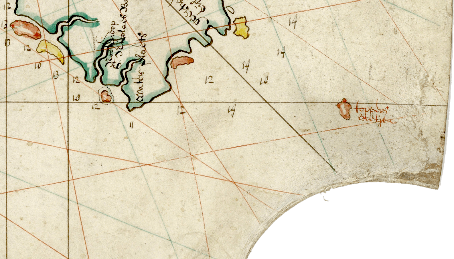
It turns out that Toppers Hoetje is a tiny island, significant in its postion at the northwest coast of Java, where it marks the turn to the south for VOC ships heading back home, and also historically, as this was the island that the survivors of the legendary Batavia shipwreck first landed on in 1628. The map we’ve been using so far, published in 1727, shows the island right on the edge.
When we plot a position using the bearing information given in the log, we can see it lines up perfectly – with the island in one direction and the “edge of the high land of Bantem” in the other. At midday on October 1st, this is precisely where the Schoonenberg was. The next time such an accurate position is available, is when she hits the rocks and sinks, in 50 days time.
“en creegen de zee windt uijt den N:Weste hadde zoveel als wij boven Brouwers Zant conde haalen: hadde maar een slap lughie zo dat wij ons schip pas conde Regeere: quaame tegens zons onder ganck om dat wij boven Brabans Hoetie niet conde zeijlen dight bij dito Ijlantie ten ancker op 15 vadem lant gront ten ancker, liep een sterke stroom omde Z:West.“
The log continues in the afternoon: “We got a sea breeze out of the northwest, took as much as we could get above Brouwers Zant, but in the end had only a weak breeze so that we could barely manage the ship. We came at sunset to Brabans Hoetje, laid anchor 15 fathoms offshore. There was a strong current south westerly“.
The ship is now in the Sunda Strait.
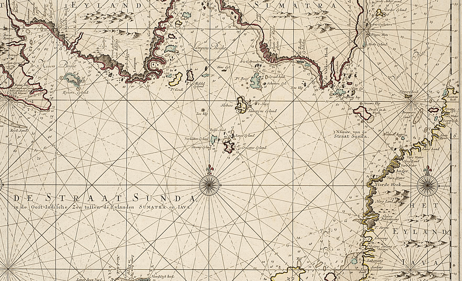
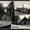
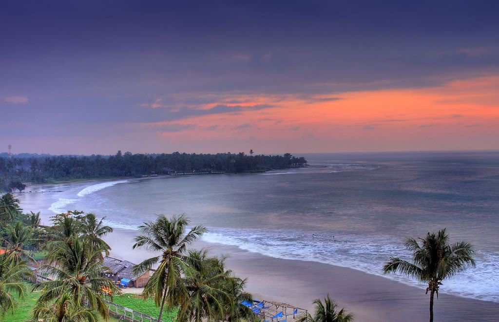
The going hasn’t been easy, but at sunset they reach the coast of Brabants Hoedje Island (Palau Ular in Indonesian, or Snake Island), and have covered 22 nautical miles. With 12 hours from sunrise (6am) to sunset (6pm) the average speed is 2 knots.
The island lies just off the coast of west Java; this is the landscape today.
Distance sailed Day 7: 22 nm
Position: 6°00′ S 105°55′ E
Total distance: 61 nm (113km)
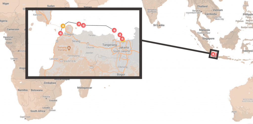
Voyage Track: Full Map
After a slow start, Week Two for the Schoonenberg has a more interesting beginning. Dead ahead of the ship, two items of interest: Krakatau, and Pirates.
Friday, October 2nd (Day 8)
“Op vrijdagh den 2 octob:r smorgens ten 3 uere creegent lant wintie uijt den zuijde met stil waater. Lighte ons ancker en ginge onder zeijl met het opkoome van de maan: met zons opganck wierte het doodt stilte: en de stroom teegen zo dat wij niet veel geavanseert waar zagen de Anna Maria onder de wal ten ancker leghe die tegent zeijn van ten ancker te koome was door geseijlt dogh light zijn ancker en gingh meede onder zeijl:
“At 3am, a land breeze sprung up from the south, water was still. We raised anchor and went under sail with the rise of the moon. At sunrise it became dead calm, and the current so against us that we did not progress far. We saw the Anna Maria lying at anchor; she raised it and sailed with us. “
The Anna Maria was the companion ship for the Schoonenberg on the voyage. Later on, the entry continues …
“Smiddaghs Pijlde de zuijt hoek van Dwars in die Weg int N: t O: van ons 1 ½ meijl passeerde op dato een Engels Schip: coomende van Lissabon”
“In the afternoon took a bearing to the south corner of Dwars in die Weg, in the N by E. 1½ miles away. Passed an English ship, coming from Lisbon“
Now is a good time to determine what exactly is meant by a mile. A nautical mile is 1,852 metres, or about 1.8 km. Importantly, 60 nautical miles is equivalent to exactly one degree of latitude; eg. sailing from 52N to 53N along any meridian of longitude will be a distance of 60 nautical miles. However, in 1722, the mile at sea at referenced by VOC ships appears to be the German mile1 – 7,407 metres, or 7.4km, or 4 nautical miles.
Dwars in die Weg is an island today called Sangiang, in the middle of the narrow part of the Sunda Strait.
With this information, we can fix the afternoon position of Schoonenberg:
“Inde aghtermiddagwaght de windt van ZW tot ZW t Z: en ZZWest: Creegen de stroom meede lagent over en weer met zons onderganck Pijlde Krakatouw Int W: t N: en des L Int Z: t W: van ons
At sunset, fixed the position of Krakatau to the W by N (280°), and the land in the S by W (190°) from us.
“de windt ZZ Oost dito name onse bramz:s en wende als doen om de west om booren Krakatouw heen t: loopen de aghtermiddagw: uijt zeijnde van koers veranderde stierde WZW: aan: daar liep een zeer sterke stroom omde ZW voors snaghs de windt van ZZO: stijve marz:s coelte goet weer. Zeijlde benoorde Prinse Ijlant heen.“
The wind was SSE, took our topgallant sails and changed to a westerly course in the direction of Krakatau, at the end of the achtermiddag watch changed course to steer WSW (245°). A very strong SW current, at night the wind was SSW, wind force 4, good weather. Sailed to the north of the Prinse Island.
More to learn here. We’ll review the ship watches later, but the achtermiddag, or afternoon watch, was from 1200-1600. The wind was measured in different “koelte’s” or strengths, as follows:
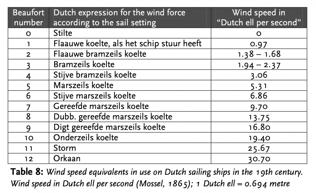
A “stijve marz:s coelte” is therefore between 11-16 knots of wind, a moderate breeze.
The Schoonenberg is now, at least, heading for the open ocean. The story continues in Part II.